
Support the Village Inn
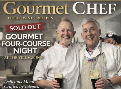
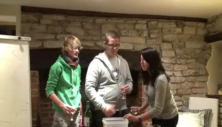
We want our local pub, The Village Inn, to thrive. A pub closes in England every day, a shocking statistic. If our local goes, that’s the focal point of the village gone. We got the support of Adam, the pub landlord, and set up a volunteer group – four retired guys and five women with attitude. The flowers in the pub are now changed every Friday which gives the place a lift. Adam and his team set out a restaurant -style room at the back of the pub and each table is laid out to a high-dining standard. For a Saturday evening in March we advertised a four-course Gourmet meal. It sold out in a few days. David did three nibbles, the gourmet starter and the main course of pheasant. Maurice was David’s commis chef and he also focused on a full array of vegetarian dishes and an olive oil chocolate cake for dessert. We’d an anxious dry run for friends earlier in the week which gave us confidence. We managed the kitchen professionally on the evening, aimed high to a Master Chef standard. The guests loved it, agreed it was a big success, offered encouraging feedback, and it was very profitable for the pub. During this year we have plans for more four-course gourmet meals. We’re not trying to change the world but with support from villagers, guests and volunteers we’ll do what we can for our pub. When the gourmet meal was finished, we left a spotless kitchen and had a pint of Guinness on the house. There’s only one poem for that, with a nod to the poet, Flann O’Brien. When things go wrong and then go right For you’ve done the best you can, When life looks sweet at close of night A pint of plain is your only man. When service is done and the kitchen’s clean And your faces are pale and wan When punters say “it was a fabulous meal” A pint of plain is your only man.
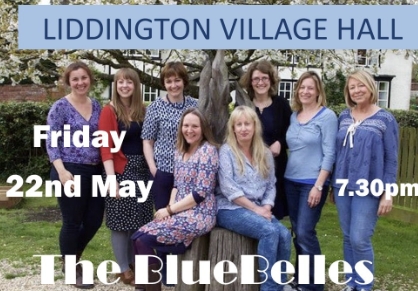
A Cappella Concert in the Village Hall
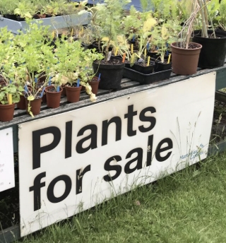
Plant Sale
Around the Village
Distance 4k This is a short walk that every villager has done at some stage. However, I’m encouraging you to take longer this time, to stop and look around. The village has old buildings and a church, a graveyard and lanes, the places where history and stories are hidden for the most part. This is an opportunity to share with a visitor to the village, as there’s nothing like a good story to enhance a walk. Where to start? The Green is the oldest area in the village. The village was originally focused around the triangular old “Green” to the east, now bordered by some of the earlier village cottages, and extended to the west to All Saints’ Church and Parsonage Farm. The Green was located at the junction of the ancient long distance east-west route known as the Icknield trackway and the north-south route from Swindon to Hungerford, named The Street. Three beautifully thatched cottages invite you up the short road. The 7th Duke of Marlborough, a black sheep who courted controversy, sold these houses to residents in 1877 to settle debts on Blenheim Palace. In the past the Green was the common between the houses until someone put up a fence and then everyone followed. The first house on the right has a layout that shows where horses were stabled and was probably a smithie as well. The next house #17 was built in the grounds of #16 by Joel Joffe (more about Joel later) for his sister but she never emigrated from South Africa. At the top of the road, Cobblers’ Cottage #18, was actually two cottages. Cobbling was undertaken here for a wide customer base across Swindon. Around the corner at the top are two modern houses. Turn around and follow the lane to the Village Inn. This lane has the honour of being the shortest public way in the village. The houses on the right are owned by Arkell’s Brewery, as is the pub. The Village Inn was originally called The Bell and there is a hint to its former identity in the road in which it stands – Bell Lane. In fact, the first Bell stood on the other side of the road before the owner, John Whitling, put up the present building in 1875. The original building, which dates back to at least 1789, was demolished in 1894. After several changes of ownership the pub was eventually renamed in 1982 and Arkell’s bought it in May 1994. But first, admire the old signpost which is slowly giving up the ghost. A recent bit of amateur engineering has given it life for now. The Parish Council have agreed to replace it, like for like. On the far side of the hedge is an old farmhouse. You can get a better view from the entrance. Mike Dixon was the last farmer there. When he retired the house was renamed Rhodes House, and the less said about that the better. In the middle of the junction is the Toll House. The main road from Swindon to Aldbourne passed to the right of the house and tolls were taken through a window. This road was turnpiked in 1813. The Toll house was built at its junction with Icknield Way, with toll gates across both roads. Traffic was horse-drawn in those days, moving at a more leisurely pace. So, that’s the centre of the village. We’ll now walk down to the left past the Toll House and the Village Inn along Bell Lane. We’ll pass the house of one of our oldest residents, Kay. She has campaigned quietly to have the pub renamed “The Bell” – too quietly in my view. I suggested a demo with placards and lying prostrate in the road, but she didn’t want to go that far. There are fine homes on the left-hand side as you walk further down. We’ll come to a signpost for Ham Road, named after the road where pigs were taken to market in Swindon or “Swine-town.” This is also the boundary with Wanborough, though most people on Ham Road are active members of Liddington parish. The village should declare a Unilateral Declaration of Independence on Ham Road. Today, we won’t go to Ham Road, as we’re following the path to the right. It is signposted Joel Joffe Way, and we’ll get to that name in a few minutes. We’ll be walking by the River Lidd on the public path. It’s usually quiet along here, the stream like an orchestra and the birds chattering as the backing choir. On the left we’ll come across a stile with the remains of a sign on it. That used to be the entrance to the Coombe. By definition a Coombe is a small valley through which a watercourse does not run. The valley is indented on both sides by lynchets, a feature of ancient field systems. They are uncommonly in horizontal rows and often referred to as “strip lynchets”. The size, location, spacing and number of rows of many strip lynchets indicates that many were man-made. It is most likely that lynchets were dug to maximise the use of land for agriculture, although they may have had other, ceremonial uses. For decades this was a permissive path. Some of us have had permission to walk it, and to be honest, even without permission we should walk it as it’s a stunningly beautiful valley with full views of sunset and sunrise from the high points. And it’s on our doorstep. There are conversations with the estate in Newbury that owns the Coombe to see if we can get permissive access again. At the end of the pathway, we’ll see the Manor House on the left. That’s worth stopping to admire. It stands on the source of the Lidd or the Liden brook which gave its name to the Parish. It’s interesting that The Domesday Book records the village as Ludentune (Saxon translation: “The homestead on the noisy stream”) and later, early church records
Waiting for Gordo
Around 2010, the Parish Council launched an initiative called the “Parish Plan” to get feedback from villagers about the future of the village. We asked the teenagers and gave them a free rein. Five of them made this video, “Waiting for Gordo” with a nod to Samuel Beckett – clever kids. Gordo is Gordon Wilson, the popular chair of the Parish Council at that time. The video was played to a full house in the Village Hall. The five teenagers now work in professional jobs in Australia, New Zealand, Bristol and London and are still a lot of fun.
Liddington to Aldbourne
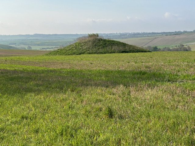
Distance: 8.8Km from the Village Inn. It’s 7.3Km if you park at the Ridgeway cross-roads. Height: 132m This is a favourite and regular walk with Rocky, and also my favourite run. It’s not a well-used path and the chance of meeting anyone until you get to the dog walkers of Aldbourne is remote. But the beauty of the rolling hills, the expanse and remoteness and yet so close to home, the downhill sprinting for intermittent fartlek runs and feeling “Chariots of Fire” in your head – it’s truly wonderful. My recommendation is that you plan the route, so you have time to browse and have a cuppa in Aldbourne and then get the bus back. If you have children with you, it can become an adventure. The bus service is reliable in arriving on time, but the frequency is not good. There are no busses on Sunday or Saturday afternoon. During the week they run every hour. Check the timetable first for 46A, 48, 48A and X46 on https://www.swindonbus.co.uk/services If you don’t trust the reliability of the bus (!), you could get the bus from Liddington to Aldbourne and walk back. The walk starts at the Village Inn. Turn left and go up The Street to the end of the road. There’s little traffic on this road. At the top of the Street be careful crossing the B4192. You’re aiming for a footpath sign on the far side of the road. It’s a bit bent at the present but it’s on the list for beautifying this part of the village. Go into the field and turn left. This is a permissive path. There was a change of owners recently and the new farmer has very kindly agreed to keep the permissive path. This will take you to the M4 bridge. Walk inside the barrier and there’s a safe footpath on the verge beyond the bridge that will take you to the crossroads. NOTE: If you are unsure about this part of the walk from the village, you could take your car and park on the right at the crossroads. The walk turns sharply away from the noise of the road by a hedge and leads up a short slope to a place worth stopping to catch your breath. You can see the snake of traffic on the M4, Fox Hill where the phone mast is, several dwellings towards the Liddington Hotel and the Burj, a fine Indian restaurant. The Burj used to be known as the Shepherds Rest pub, and it really irritated me as there was no apostrophe in the name. Was it one shepherd or multiple shepherds? Another conversation with the kids! Continue over the Ridgeway road on the right-hand side of the road. Just beyond the large roadway sign you’ll see a marker for the right of way on the other side of the road. Be careful crossing the road and you’re into the field. The path is marked to your right. Don’t rush though, as a few steps along you’ll see a fox hole under the path. Lots to chat to kids about there! Keep walking and soon you’ll move away from the B4192 and you can let your dog and children loose. You have a good view of Manor Farm. Robert and Charley Bland are regulars in the Village Inn and they can tell a story or two. Go through the next gate and enjoy this lovely track. Even after winter rain, it’s always dry and you can see why it appeals to a runner. In the images below, on your left, you’ll see two gorgeous deciduous woods, called The Moon and the Half Moon. I had the pleasure of running through them some years back before Robert reminded me that they were private! I have fond memories of them, and even based a short story on the Half Moon. As this walk was photographed in April, you won’t see the woods in their glory yet. The track steepens a bit here as you look down on Liddington Warren Farm which has facilities for music events and weddings and is farmed by the Ford family. You’ll also see sheep so be careful with your dog. I like this sign. It shows respect and is caring – so different to many “keep out of here” aggressive signs. You now come to another circular gate. Liddington Hill is off to your right and will soon be out of sight. Go left for about a hundred metres and there’s a signpost to go right. Before you turn right, enjoy the view towards the motorway, the silent lines of traffic snaking the brow. Beyond the gate there’s a lovely deciduous wood. A local told me the farmer doesn’t mind people strolling in there and coming out again about a hundred metres up the hill – which is my way. This could be a truffle wood. In England, truffles are mostly found near the roots of oak, hazel, beech, and birch trees and this is a perfect spot. Truffles are mycorrhizal with these tree species, meaning they form a symbiotic relationship with the roots, benefiting both the fungus and the tree. A friend of mine spent a year training his spaniel to sniff truffle oil. He’d dig a hole and put truffle oil in it in and the spaniel was on it so quickly. It was very impressive. He came up here to try the spaniel out on these woods. The spaniel was perfect on truffle oil but not so great on digging for truffles. They’re still safe. You’re on Sugar Hill now and the beginning of the Barrows that are common around Aldbourne. As you descend, on your right there’s a small mound. This is a bowl barrow about 3m high and 23m in diameter. Most bowl barrows date from the period 2400-1500 BC. The site was partially excavated by Canon Greenwell, a prolific excavator of barrows, between 1885 and 1890. Finds included the cremated remains of an
Village Hall AGM

Monday 22 June 2025 from 7pm to 10pm Annual General Meeting Village Hall Management Committee Members of the public are welcome to attend. Please email ababington@btinternet.com if you wish to attend.
Liddington Hill and Clump
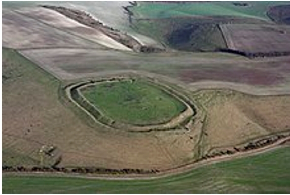
Distance: 7.5K Height: 190m This is one of my favourite walks with several opportunities to deviate or turn back at any stage if the weather is inclement, or the kids complain, or you’re huffing and puffing and decide you’ve had enough. On a fine day, it’s a glorious walk. HOW TO USE THE MAP The red line indicates the walk. Click on the 2D map. It will take you to the Ordnance Survey where you have more detail. You can have fun with several options if you have a subscription – such as the “Fly-through.” Start by heading along the Street to the B4192. Cross over into Church Road. You can walk up by the Village Hall and into the graveyard where there’s a permissive path. I prefer to go to the top of Church Road and on to the playing field that way. Let the dead rest. Either way, at the exit from the graveyard in the playing field, go through the swing gates and walk to the right of the playing field. There are delightful views from this path, so take them in. There’s no rush. The walk turns left with overhanging branches as if you’re in a tunnel – just like Alice in Wonderland. In the autumn this is the place to pick crab apples on the left and sloes on the right. At the bottom there’s another swing gate and you’re into an open space. The famous sheep who keep escaping are now on your left and well tethered. When they’re not there that little valley is lovely to explore. You’re bound to see roe deer and rabbits and I’ve often seen a kestral. Continue down the track to your right. You’ll see some containers where the clay-pigeon guys shoot at 11am every second Sunday. If you’re walking on that Sunday, there’ll be a bell to let them know. They’ll stop and bid you good morning. If you fancy, ask for Bill Crowley and tell him I sent you. Ask if you can observe and he may even give you instruction and a few shots. The path goes to the right. It’s usually a bit muddy there. You’ll come to a farm track. Go left at the signpost towards the motorway. If this is your first visit, be prepared for the cave drawings under the bridge. I think they’re fabulous. I met the artist there a while back and he was so excited about his work it was contagious. Sometimes it’s wet underfoot in the tunnel. One time, I tried walking on the wall on the right. Great fun for the kids, silly for adults. I got half-way, lost my balance and in the kerfuffle of a huge splash, plus profanity at my sodden dignity, Rocky ran off. Beyond the tunnel, a rope over a metal rod is on the right of the gate. Take a moment to consider what you do next. In summer, the field in front of you may have horses or cattle. They are used to people and won’t bother you so you can walk straight on. If you’re anxious, I suggest you go immediately left and up the bank to the fence-line. The animals won’t follow you and you have an escape gate about half-way into the next field. If you have a dog and there are cattle there, let your dog off the lead. The cattle will only be interested in the dog, and it can scarper between their legs. If you keep your dog on the lead or lift it up into your arms, you’re looking for trouble. Don’t do it. Enjoy the walk up the field to the Ridgeway Road. Don’t go through the gate. The official path is to your left and through a swing gate. Put your dog on a lead here and watch the kids, as this road has fast cars. . On the far side of the road there’s a gate which will not open. To the right of the gate, you can lift the wire, hoosh your dog through and then climb over. You’re now on a permissive path so stick to the path. All the paths on the Hill are permissive paths, thanks to Farmer Peploe. Show appreciation by avoiding the animals and being aware of litter. It’s a steep path, really the only challenge on this walk. Take your time and stop to look back. I’m always fascinated at how much height you gain in only a few minutes of walking here. There may be sheep in the field so put your dog on a lead. At the top, there’s another swing gate and you have choices. If you go through and turn immediately left you can walk along the fence to the Clump, about five minutes away. OPTION Otherwise, you can cut the walk short. Don’t go through the swing gate. Turn right instead and walk along the fence on the permissive path to Liddington Fort. It’s about 200m to the next gate into the fort. THE CLUMP Let’s start with the Clump. It’s an iconic area of trees which you can see coming from London on the M4 or from the train into Swindon. I always get a lift from it, nearly home now. The concrete bunker is from World War II. During the war soldiers managed a Starlight Decoy bunker from here, placing beacons and fires around the top of the hill. The bunker has a central passage with the control room on the left and a hatch in the roof. The generators were in the room on the right. The soldiers distracted Luftwaffe bombers from hitting the railway works in Swindon. Usually on a bombing raid, which was normally at night, small incendiary bombs would be dropped on the target by a Luftwaffe plane. This would guide the bombers in. The Starlight Decoy encouraged bombers to bomb the hill instead. There are a few signs on drone videos of bomb craters, though most have been filled in.