
Distance: 7.5K Height: 190m
This is one of my favourite walks with several opportunities to deviate or turn back at any stage if the weather is inclement, or the kids complain, or you’re huffing and puffing and decide you’ve had enough.
On a fine day, it’s a glorious walk.
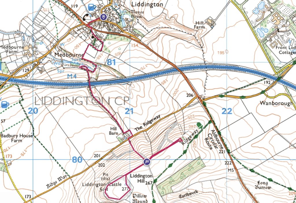
HOW TO USE THE MAP
The red line indicates the walk. Click on the 2D map. It will take you to the Ordnance Survey where you have more detail. You can have fun with several options if you have a subscription – such as the “Fly-through.”
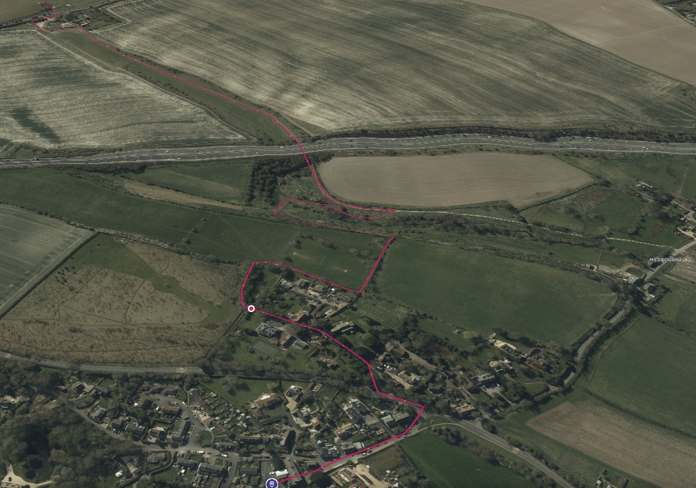
Start by heading along the Street to the B4192. Cross over into Church Road. You can walk up by the Village Hall and into the graveyard where there’s a permissive path. I prefer to go to the top of Church Road and on to the playing field that way. Let the dead rest.
Either way, at the exit from the graveyard in the playing field, go through the swing gates and walk to the right of the playing field.
There are delightful views from this path, so take them in. There’s no rush.
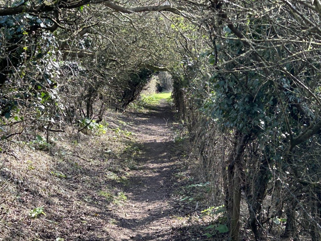
The walk turns left with overhanging branches as if you’re in a tunnel – just like Alice in Wonderland. In the autumn this is the place to pick crab apples on the left and sloes on the right.
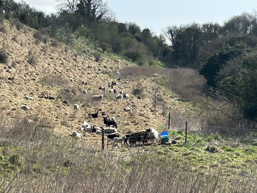
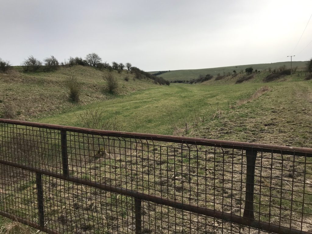
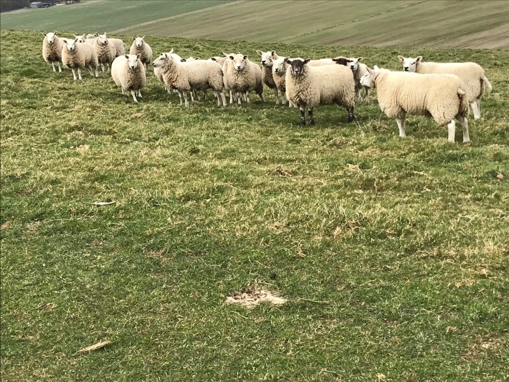
At the bottom there’s another swing gate and you’re into an open space. The famous sheep who keep escaping are now on your left and well tethered. When they’re not there that little valley is lovely to explore. You’re bound to see roe deer and rabbits and I’ve often seen a kestral.
Continue down the track to your right. You’ll see some containers where the clay-pigeon guys shoot at 11am every second Sunday. If you’re walking on that Sunday, there’ll be a bell to let them know. They’ll stop and bid you good morning.
If you fancy, ask for Bill Crowley and tell him I sent you. Ask if you can observe and he may even give you instruction and a few shots.
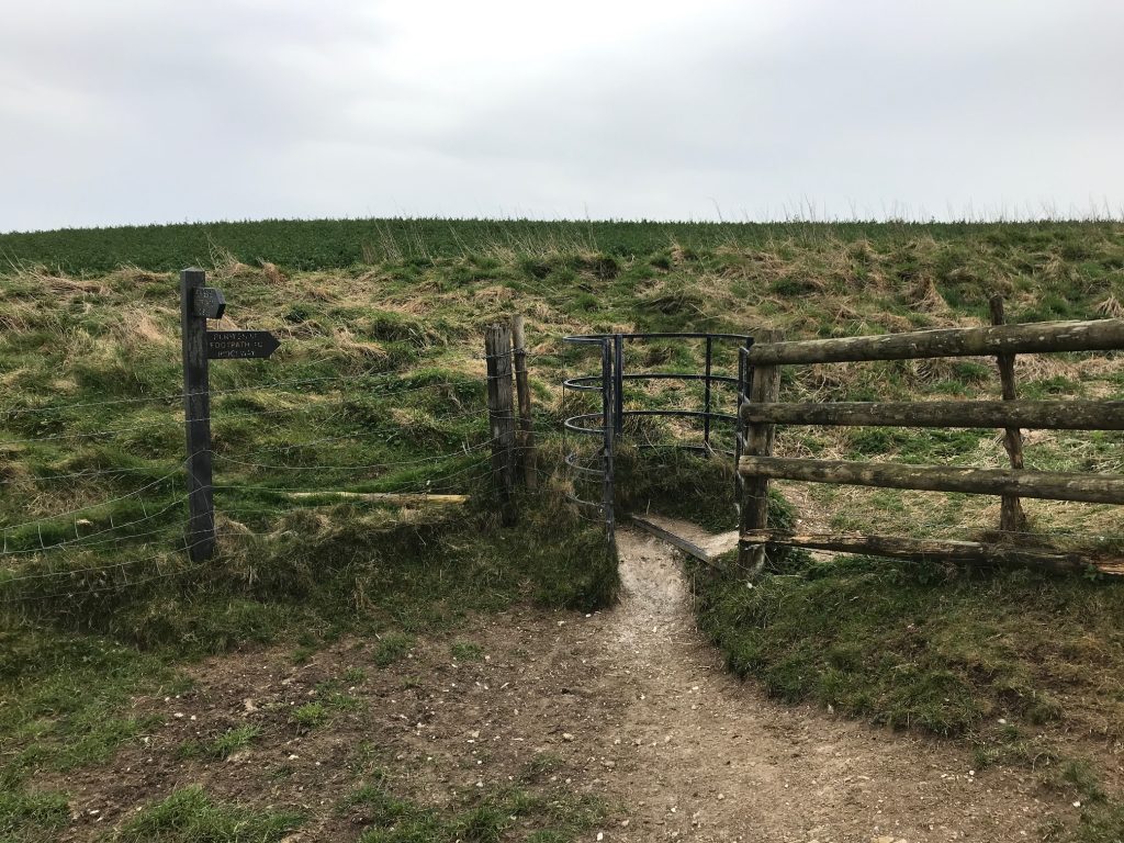
The path goes to the right. It’s usually a bit muddy there. You’ll come to a farm track. Go left at the signpost towards the motorway.
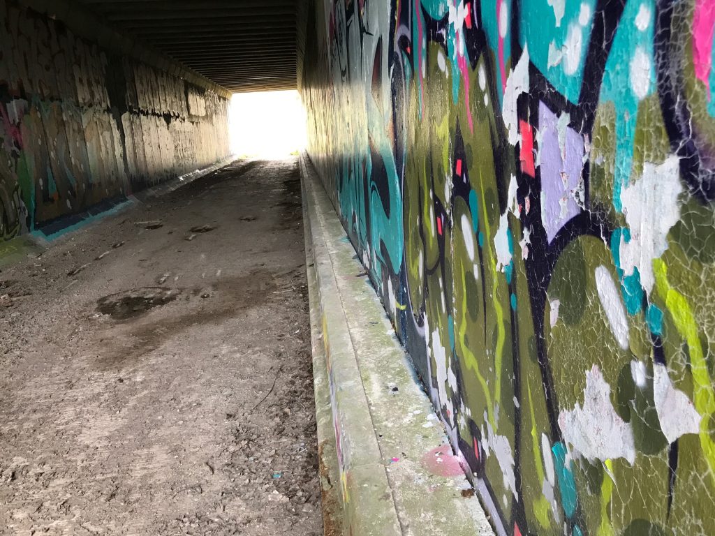
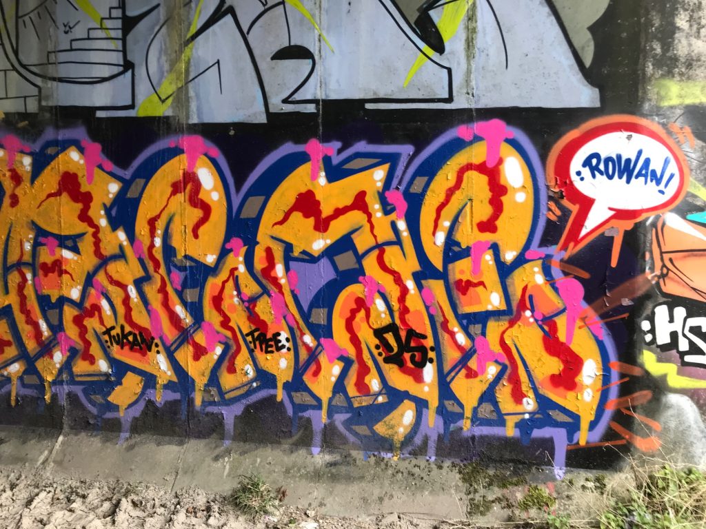
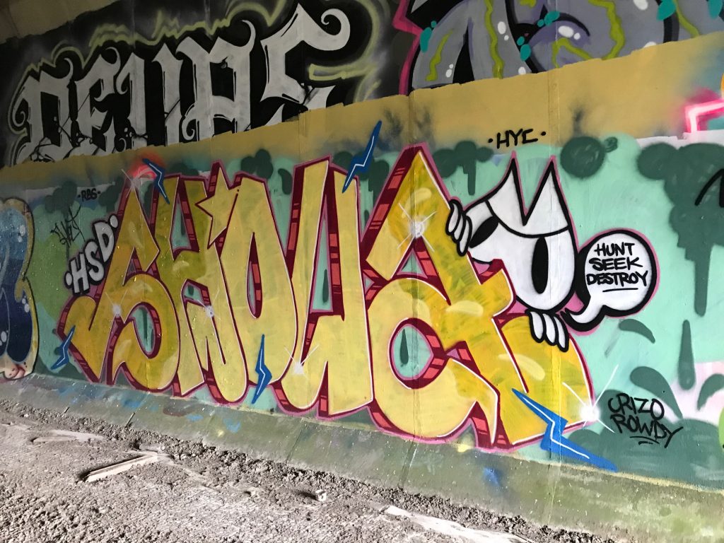
If this is your first visit, be prepared for the cave drawings under the bridge. I think they’re fabulous. I met the artist there a while back and he was so excited about his work it was contagious.
Sometimes it’s wet underfoot in the tunnel. One time, I tried walking on the wall on the right. Great fun for the kids, silly for adults. I got half-way, lost my balance and in the kerfuffle of a huge splash, plus profanity at my sodden dignity, Rocky ran off.
Beyond the tunnel, a rope over a metal rod is on the right of the gate. Take a moment to consider what you do next.
In summer, the field in front of you may have horses or cattle. They are used to people and won’t bother you so you can walk straight on. If you’re anxious, I suggest you go immediately left and up the bank to the fence-line. The animals won’t follow you and you have an escape gate about half-way into the next field.
If you have a dog and there are cattle there, let your dog off the lead. The cattle will only be interested in the dog, and it can scarper between their legs. If you keep your dog on the lead or lift it up into your arms, you’re looking for trouble. Don’t do it.
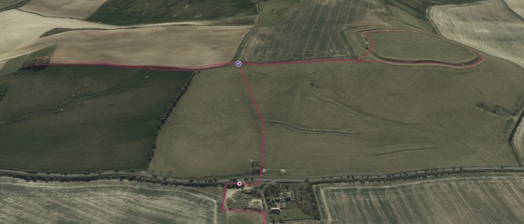
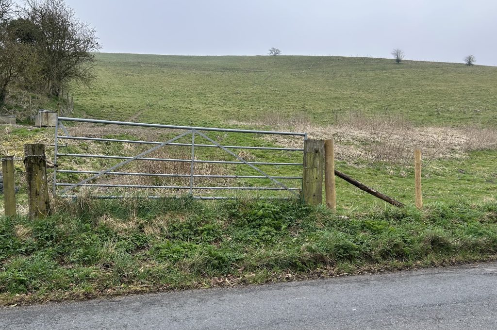
Enjoy the walk up the field to the Ridgeway Road. Don’t go through the gate. The official path is to your left and through a swing gate. Put your dog on a lead here and watch the kids, as this road has fast cars.
.
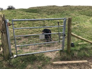
On the far side of the road there’s a gate which will not open. To the right of the gate, you can lift the wire, hoosh your dog through and then climb over. You’re now on a permissive path so stick to the path.
All the paths on the Hill are permissive paths, thanks to Farmer Peploe. Show appreciation by avoiding the animals and being aware of litter.
It’s a steep path, really the only challenge on this walk. Take your time and stop to look back.
I’m always fascinated at how much height you gain in only a few minutes of walking here. There may be sheep in the field so put your dog on a lead.
At the top, there’s another swing gate and you have choices. If you go through and turn immediately left you can walk along the fence to the Clump, about five minutes away.
OPTION
Otherwise, you can cut the walk short. Don’t go through the swing gate. Turn right instead and walk along the fence on the permissive path to Liddington Fort. It’s about 200m to the next gate into the fort.
THE CLUMP
Let’s start with the Clump. It’s an iconic area of trees which you can see coming from London on the M4 or from the train into Swindon. I always get a lift from it, nearly home now.
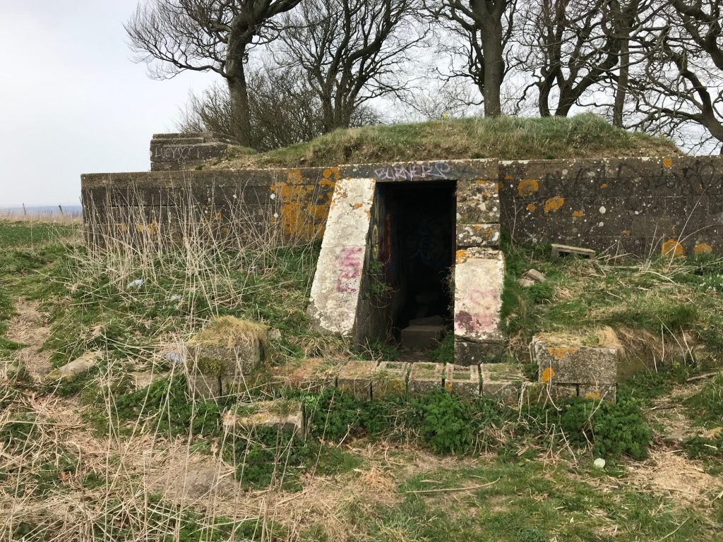
The concrete bunker is from World War II. During the war soldiers managed a Starlight Decoy bunker from here, placing beacons and fires around the top of the hill. The bunker has a central passage with the control room on the left and a hatch in the roof. The generators were in the room on the right.
The soldiers distracted Luftwaffe bombers from hitting the railway works in Swindon. Usually on a bombing raid, which was normally at night, small incendiary bombs would be dropped on the target by a Luftwaffe plane. This would guide the bombers in. The Starlight Decoy encouraged bombers to bomb the hill instead. There are a few signs on drone videos of bomb craters, though most have been filled in.
Do take a moment to imagine the soldiers staying at night in that bunker.
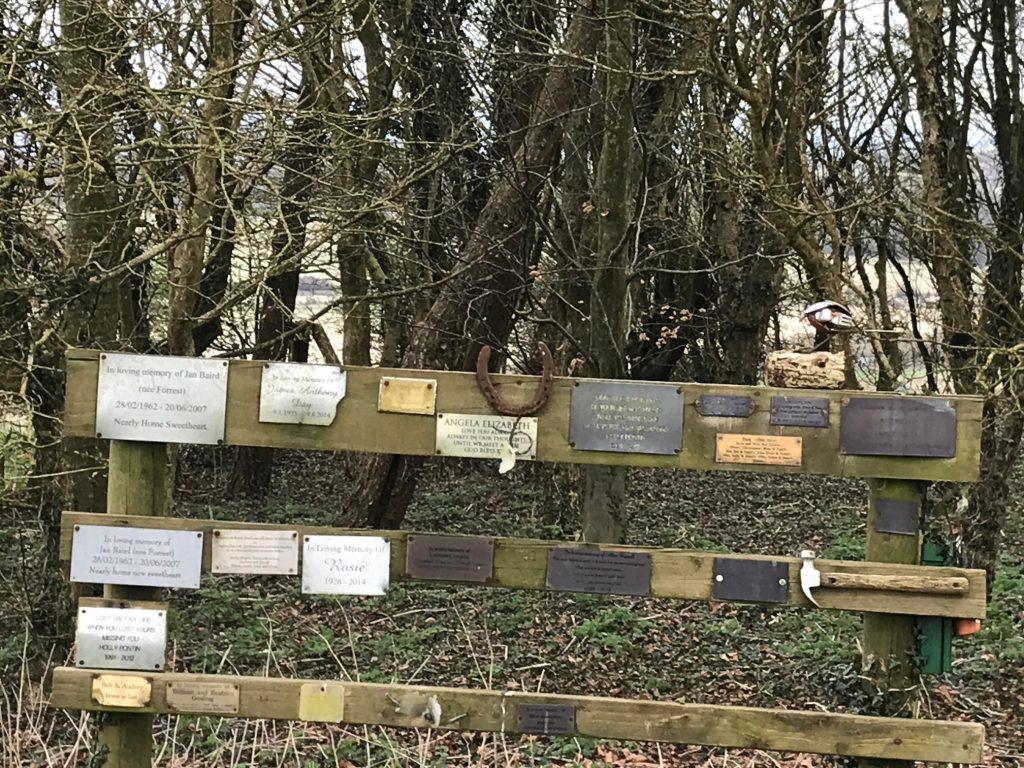
Behind the bunker, you’ll find a peaceful place of remembrance. It was a mess some years ago, but volunteers cleaned it up and it’s pleasant to walk about and see the names of the departed. In February I was up here with my friend, Simon. He gave a crying shriek and when I went over to him, he’d seen the name of his first girlfriend. He knew she’d been ill, but not that she’d died. It was upsetting and of course became a longer story as we walked on.
I bring a small bag when I come up here and take away any rubbish. It’s generally clean these days but I’m sure you’ll find beer cans and crisp packets that I’ve missed.
There’s a stile into the field by the fence. You can walk back to the swing-gate that way or go back the way you came across the field.
When you get back to the swing gate, you’ll notice a sign for the permissive path to Liddington Camp. It’s not far but make sure you’re walking on the Liddington side of the fence.
You’ll reach a gate dedicated to a walker, Henry King. Go on through and you’re into Liddington Fort.
LIDDINGTON FORT
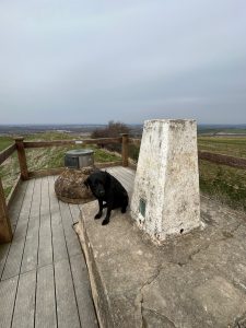
The Camp, or Castle or Fort or whatever you call it, is amazing.
Walk towards the Trig point and here is a good place to take your ease (Lig do scíth, as the Celts would probably have said in this spot). I enjoy sitting here on my own and thinking about the ages.
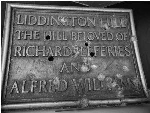
This fort was a big inspiration to the nature writer, Richard Jefferies (1848-1887). His museum on the Marlborough Road, just before Coate, is the outer limit of Liddington parish. Strangely, I read recently that he considered Chiseldon as his parish church, yet Liddington is nearer.
He is commemorated here on a plaque, along with Alfred Williams (1877-1930), put up by Liddington Parish Council to mark the centenary year 2000. Alfred Williams is affectionately called “The Hammerman Poet” and he’s the author of “Life in a Railway Factory.” I’m a big fan of his work.
The original plaque was used by American soldiers as target practice in WWII. You can see it in the Jefferies Museum.
HISTORY OF THE FORT
The fort is a late Bronze Age 700 BCE and early Iron Age univallate hillfort. The reason for the emergence of hillforts in Britain, and their purpose, has been a subject of debate. It has been argued that they could have been military sites constructed in response to invasion from continental Europe, sites built by invaders, or a military reaction to social tensions caused by an increasing population and consequent pressure on agriculture.
The dominant view, since the 1960s, has been that the increasing use of iron led to social changes in Britain. Deposits of iron ore were in different places to the tin and copper ore necessary to make bronze and, as a result, trading patterns shifted, and the old elites lost their economic and social status. Power passed into the hands of a new group of people.
Archaeologist Barry Cunliffe believes that population increase still played a role and has stated “[the forts] provided defensive possibilities for the community at those times when the stress [of an increasing population] burst out into open warfare. But I wouldn’t see them as having been built because there was a state of war. They would be functional as defensive strongholds when there were tensions and undoubtedly some of them were attacked and destroyed, but this was not the only, or even the most significant, factor in their construction”.
Hillforts in Britain are known from the Bronze Age, but the great period of hillfort construction was during the Celtic Iron Age, between 700 BC and the Roman conquest of Britain 43 AD.

A PERSONAL VIEW
Followers of King Arthur believe Liddington Hill was Mons Badonicus the site of the Battle of Badon Hill. It was King Arthur’s last battle and a decisive victory over the Saxons sometime around 516-518 AD.
“The twelfth battle was on Badon Hill and in it 960 men fell in one day, from a single charge of Arthur’s,” reads an ancient account, “and no-one laid them low save he alone.”
I know there are lots of other possible sites – many are associated with places called Badon – but this is my choice, and there are experts who agree, so there.
AND ANOTHER STORY!
As this was the Ridgeway, my take on the Liddington fort is that, as a wooden palisade, it would have been a place of refuge at night for travellers and their animals moving along the Ridgeway from coast to London.
Wolves were dominant then and the area below the hill was forested and dangerous. It’s a good conversation to have with children, imagining the walk at height from Barbury Castle to avoid wolves! Turkeys were also herded along the route at a slow pace.
Did you know they wore leather shoes tied at the ankle, otherwise their feet would’ve been very sore! It’s true . . . However, geese wouldn’t allow themselves to be shod so their feet were dipped in tar and covered with sand.
CONTINUING YOUR WALK
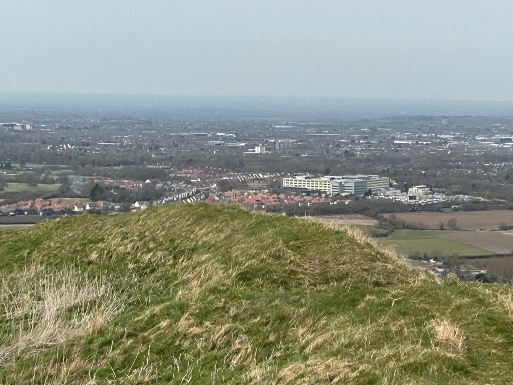
As you’ve come this far, you really should walk around the fort and take in the views. You’ll get your bearings from the memorial and identify Barbury Castle and GW Hospital and as far away as Oxford.
And now we head for home which is a lot quicker than coming up!
Go back to the gate and turn right. When you come to the swing gate again, turn sharp left down the hilld, following the disused fence towards the house below. Over the fence but this time get over yourself first and then help your dog through. Cross the Ridgeway Road, being very careful.
Retrace your steps into the field and it’s an easy walk back to Liddington and the Village Inn for a cuppa or a pint.